| Geostationary satellites |
|
2018-01-12 12:01:35
Radio interferometric network for Experimental radiointerferometric network was created with the purpose of providing independent continuous orbital support to the future Ukrainian geostationary telecommunication satellite (GTS) "Lybid". The network can be used to monitor the technological maneuvers of GTS, to detect the facts of its collision with space debris, to clarify a model of moving objects in geostationary orbits. The basic principle of network operation is the use of passive radar method and correlation analysis to calculate TDOA (Time Difference Of Arrival) using signals of digital satellite television. The network receives these signals that are compliant with the standard of DVB-S (Digital Video Broadcasting-Satellite). Orbital position of satellite is determined by using measured values of the TDOA and station coordinates. To calculate the perturbed orbit of GTS, the network must consist of four or more stations.
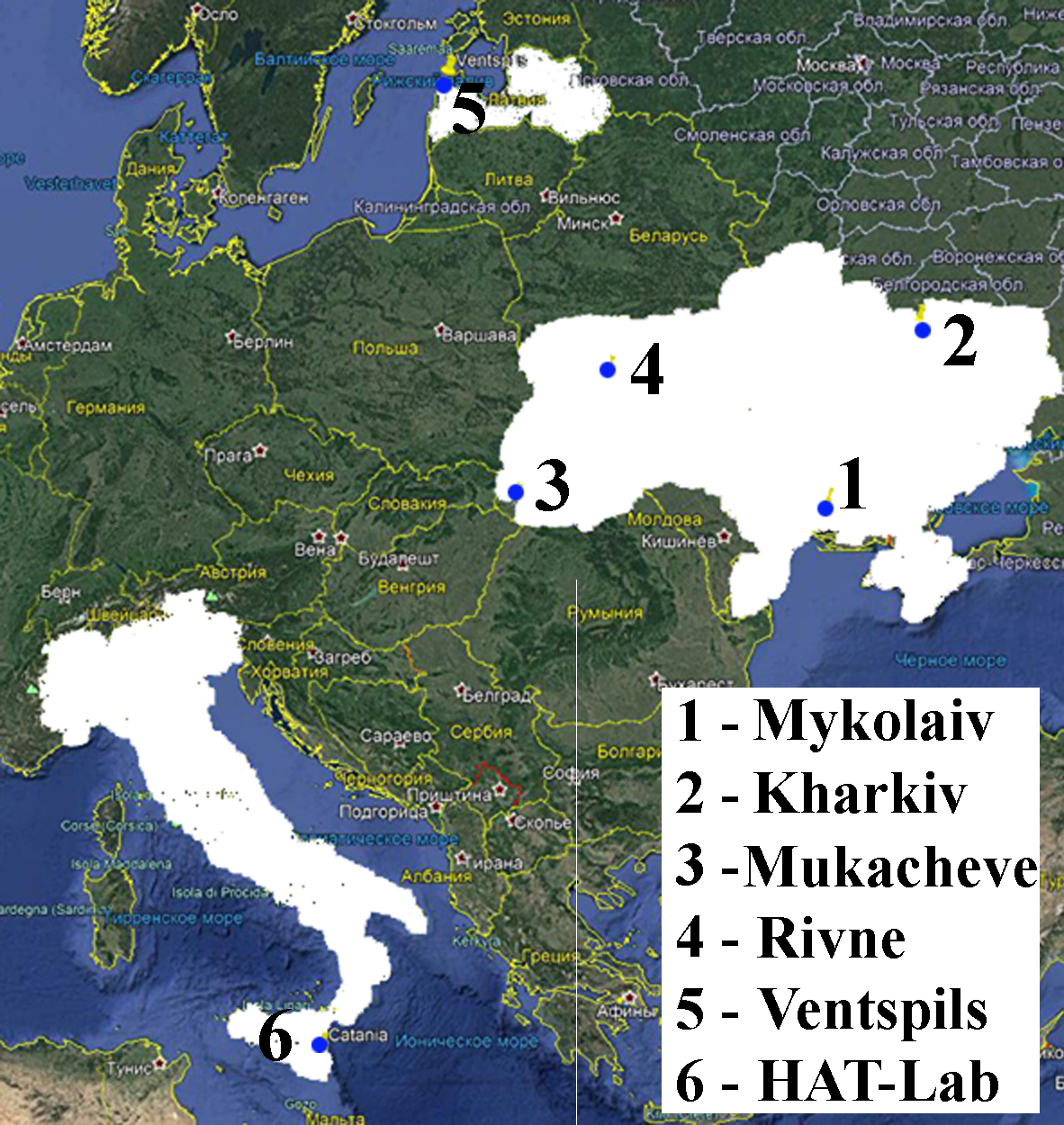
Today, the network consists of ten stations located in: - Institute of Radio Astronomy (Kharkiv); - Western Center of Radio Surveillance (Mukacheve); - Rivne Minor Academy of Sciences (Rivne); - Ventspils University College (Ventspils, Latvia); - HAT-Lab srl (Pietramarina near Etna, Italy). Three stations are placed in the RI “MAO” (Mykolaiv). Rivne and Ventspils have two stations each.
The stations have the following numbers: 0, 6, 7 - Mykolaiv; 1 - Kharkiv; 2 - Mukacheve; 3 - Kyiv; 4, 9 – Ventspils; 5, 8 – Rivne, 10 – HAT-Lab srl. The Cartesian orbital parameters are determined by diurnal arrays of TDOA values using a numerical model, which takes into account the perturbations caused by the gravitational attraction of the Moon, the Sun and the nonspherical Earth. The orbital parameters are given by using three lines. Line #0 contains the following information: - the time moment (UTC) when the orbital parameters were determined; - number of station pairs; - station numbers separated by "x"; - number of time readings with increment of one minute for which TDOA values were obtained by at least three different pairs of stations and used for determination of the orbital patameters. Line #1 contains NORAD ID and coordinates (X, Y, Z) in meters in the EME2000 reference frame. Line #2 contains NORAD ID and velocities (dX/dt,dY/dt,dZ/dt) in meters per second. Let i, k be the station numbers given in line #0 and separated by the sign "x". This pair of stations corresponds to the TDOA value Δτ, calculated using the following formula:
Δτ = τi - τk ,
The Cartesian orbital parameters of HOTBIRD 13B: 2015, 2016, 2017, 2018, 2019, 2020
The Cartesian orbital parameters of HOTBIRD 13C: 2018, 2019, 2020
|
Науково-дослідний інститут
Миколаївська астрономічна обсерваторія
Міністерство освіти і науки
Миколаївська астрономічна обсерваторія
Міністерство освіти і науки

 |
 |
 |